扫一扫
关注中图网
官方微博


本类五星书更多>
-
>
湖南省志(1978-2002)?铁路志

-
>
公路车宝典(ZINN的公路车维修与保养秘籍)
-
>
晶体管电路设计(下)
-
>
基于个性化设计策略的智能交通系统关键技术
-
>
德国克虏伯与晚清火:贸易与仿制模式下的技术转移
-
>
花样百出:贵州少数民族图案填色
-
>
识木:全球220种木材图鉴


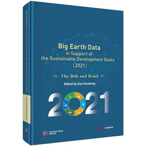
地球大数据支撑可持续发展目标报告(2021):“一带一路”篇(英文版) 版权信息
- ISBN:9787030711434
- 条形码:9787030711434 ; 978-7-03-071143-4
- 装帧:一般胶版纸
- 册数:暂无
- 重量:暂无
- 所属分类:>
地球大数据支撑可持续发展目标报告(2021):“一带一路”篇(英文版) 内容简介
BigEarthDatainSupportoftheSustainableDevelopmentGoals(2021):TheBeltandRoadshowcasestheinnovativepracticeofapplyingBigEarthDatatothemonitoringandevaluatingindicatorsforsixSDGs,i.e.,SDG2ZeroHunger,SDG6CleanWaterandSanitation,SDG11SustainableCitiesandCommunities,SDG13ClimateAction,SDG14LifebelowWater,SDG15LifeonLand,andtheanalysisoftheinteractionsamongmultipleSDGindicators.Itpresents42casestudieson22targetsrelevanttocountriesandregionsinvolvedintheBeltandRoadInitiative.Thereportshowcasestheresultsofresearch,monitoring,andevaluationofSDGsandtheirindicatorsatfourscales~local,national,regional,andglobal^totalling37dataproducts,19methodsandmodels,and32decision-supportrecommendations.TheseresearchresultsdemonstrateChina''''sexplorationandpracticeinpromotingtheimplementationoftheUN2030AgendaforSustainableDevelopmentthroughscientificandtechnologicalinnovation,fullyrevealtheapplicationvalueandbroadprospectsofEarth''''sbigdatatechnologyinmonitoringandevaluatingthesustainabledevelopmentgoals,andopenupnewwaysandmethodstosupporttheimplementationoftheUN2030AgendaforSustainableDevelopmentthroughtheuseofadvancedtechnologiesandmethodssuchasbigdataandartificialintelligenceundertheframeworkoftheUNtechnologypromotionmechanism.Itcanprovidereferenceforcountriestostrengthentheimplementationmonitoringandevaluationoftheagenda.
地球大数据支撑可持续发展目标报告(2021):“一带一路”篇(英文版) 目录
Contents
i Preface
v Foreword
ix Executive Summary
Chapter 1 Introduction / 1
Chapter 2 SDG 2 Zero Hunger
Background / 8
Main Contributions / 9
Case Studies / 11
2.1 Assessment of global livestock productivity and China’s contribution / 11
2.2 Dynamic changes in grassland above-ground biomass in representative East African countries / 19
2.3 Analysis of cropland area change in the 21st century in the Zambezi River basin / 27
2.4 Cropland dynamic change in the Mediterranean region from 2010 to 2020 / 34
2.5 Monitoring desert locusts in Asia and Africa / 40
2.6 Global data tracking of the CBD benefit-sharing of microbial resources / 46
2.7 Food security and agricultural sustainability in major regions of Asia, Europe and Africa / 51
Summary / 62
Chapter 3 SDG 6 Clean Water and Sanitation Background / 66
Main Contributions / 67
Case Studies / 69
3.1 Changes in black and odorous water bodies in representative cities of Europe and Asia / 69
3.2 Monitoring and evaluating the dynamic changes in global lake water clarity / 81
3.3 Change in water transparency in Africa from 1985 to 2020 / 88
3.4 Assessment of changes in global crop water-use efficiency / 96
3.5 Comparative analysis of the implementation of IWRM and water stress in Lancang-Mekong countries / 101
3.6 Mapping of global wetland conservation priority areas / 110
Summary / 117
Chapter 4 SDG 11 Sustainable Cities and Communities Background / 120
Main Contributions / 121
Case Studies / 123
4.1 Monitoring shanty towns in major cities of some regions involved in the Belt and Road Initiative / 123
4.2 Land cover variability and its driving factors in global big cities (2021) / 130
4.3 Analysis of land use efficiency for cities of the countries involved in the Belt and Road Initiative with different urban sizes / 135
4.4 Comprehensive assessment of urbanization at World Cultural Heritage Sites in the countries involved in the Belt and Road Initiative and the neighboring countvies / 145
4.5 Measures and findings of interference at World Cultural Heritage Sites for SDGs / 150
4.6 Monitoring and evaluation of protection indicators of global World Natural Heritage Sites / 159
Summary / 165
Chapter 5 SDG 13 Climate Action
Background / 170
Main Contributions / 171
Case Studies / 174
5.1 Variation in the range of heatwave influence in the Eastern Hemisphere / 174
5.2 Global burned area distribution and changes / 180
5.3 Vulnerability prediction of freeze-thaw disasters in High-mountain Asia / 184
5.4 Flood changes and analysis of disaster reduction in Pakistan from 2010 to 2020 / 190
5.5 Global CO2 emissions and spatiotemporal variations from gas flaring in oil production fields / 195
5.6 Temporal and spatial changes in global soil respiration and its response to climate change / 200
5.7 Impacts of land cover change on global net ecosystem productivity / 207
5.8 Simulation of spatiotemporal characteristics of Eurasian glacier retreat and evaluation of its effects on water resources / 211
5.9 Monitoring and evaluation the freeze-thaw changes of polar ice sheet / 217
5.10 Global ocean heat content change / 227
5.11 Response of terrestrial ecosystems to climate change in Northwest China and five countries in Central Asia / 231
Summary / 239
Chapter 6 SDG 14 Life Below Water Background / 244
Main Contributions / 246
Case Studies / 247
6.1 Spatial distribution characteristics of microplastics in representative areas of Antarctica / 247
6.2 Coastal flood monitoring products for Bangladesh from 2016 to 2020 / 256
6.3 Global mangrove forests spatial distribution monitoring in 2020 / 263
6.4 Spatial distribution of global coastal aquaculture ponds / 268
6.5 Remote sensing assessment of coastal resources in Mozambique for marine spatial planning / 274
Summary / 278
Chapter 7 SDG 15 Life on Land Background / 282
Main Contributions / 283
Case Studies / 284
7.1 Global/regional forest cover (2020) / 284
7.2 Event-based analysis of global forest change in the 21st century / 289
7.3 Dynamic monitoring and control measures of land degradation and restoration in Mongolia (2015-2020) / 297
7.4 Ecological vulnerability assessment along the Bangladesh-China-India-Myanmar Economic Corridor / 303
7.5 High-resolution global monitoring of the mountain green cover index / 313
Summary / 318
Chapter 8 Interactions Among SDG Indicators Background / 322
Main Contributions / 325
Case Studies / 326
8.1 Trade-offs of the food-water-air quality nexus over the
breadbasket of India / 326
8.2 Simulation and analysis of land use evolution in regions involved in the Belt and Road Initiative under the constraints of multiple SDGs / 332
Summary / 339
Chapter 9 Summary and Prospects / 343
References / 348
Acronyms / 361
展开全部
地球大数据支撑可持续发展目标报告(2021):“一带一路”篇(英文版) 节选
Chapter 1 Introduction In a push to achieve all 17 SDGs by 2030, the United Nations formally launched in January 2020 the Decade of Action, calling for accelerating sustainable solutions to the world’s greatest challenges. However, the COVID-19 pandemic has had a serious impact on the global implementation of the 2030 Agenda for Sustainable Development. It has increased the vulnerability of the global food system, with the number of people facing hunger in 2020 increasing to about 118 million, or 18% higher than in 2019, and food security emergencies at the highest level in five years. Over the past century, global water use has grown at more than twice the rate of population growth, and the United Nations estimates that global freshwater resources will decline by 40% by 2030, making a water crisis highly likely. Prior to the pandemic, cities already saw growing numbers of slum-dwellers, more polluted air, minimal public open space, and limited public transportation. The pandemic has further exposed and aggravated such vulnerabilities. The concentration of major greenhouse gases in the atmosphere continues to increase, with 2015-2020 being the warmest six years on record. Climate change has made the achievement of many SDGs less likely. The ocean constantly faces threats such as pollution, warming and acidification, which are disrupting the marine ecosystem. Deforestation and forest degradation, the continued loss of biodiversity, and the degradation of ecosystems are having far-reaching impacts on human wellbeing and survival. The global target of halting biodiversity loss by 2020 was not met (United Nations, 2021a, 2021b). The Sustainable Development Goals Report 2021 of the United Nations points out the need for concerted efforts to support a recovery guided by the 2030 Agenda for Sustainable Development, and the acquisition and the availability of data is one of the key factors in achieving a better recovery. Data that support monitoring and evaluation of SDGs have increased significantly over the years, but major gaps remain in terms of geographic coverage and timeliness of data. The Global SDG Indicators Database reveals that more than 80% of countries have data for only a few SDGs, and for most SDGs, data timeliness is a serious problem (United Nations, 2021c). These data gaps hinder the real-time monitoring of progress toward the goals and the assessment of regional disparities. Data innovation is the key to closing the gaps and accelerating the realization of SDGs, and an important area of such innovation is the fusion of geospatial information and statistical information. Earth observation data collected by satellites, unmanned aerial vehicles and ground sensors can supplement official statistics and survey data, and fuse with traditional data to create high-quality information that is more timely and spatially representative. This type of Earth observation data with spatial attributes, referred to as Big Earth Data, has strong spatiotemporal and physical correlations and good controllability of data generation methods and sources, in addition to the general properties of big data: massive, multi-source, heterogeneous, multitemporal, multi-scale and nonstationary (Guo, 2017; Guo et al., 2016). Big Earth Data can help us understand the complex interactions and evolutionary processes between Earth’s natural systems and human social systems, thus contributing to the realization of the SDGs. Big Earth Data science includes these main technological systems: (1) ubiquitous sensing of Big Earth Data, (2) credible Big Earth Data sharing, (3) multiple Big Earth Data fusion, (4) Big Earth Data digital twin and complex process simulation, and (5) intelligent cognition of Big Earth Data (Figure 1.1). Using Big Earth Data to support SDG monitoring and evaluation has the following unique advantages. First, monitoring results are more transparent and repeatable due to data from diverse sources verifying each other. Second, information on spatial differences and dynamic changes is linked to SDG indicators, enabling decision-makers to use the former to detect and address the imbalances and weak links in the latter to identify changing trends and policy effects. Figure 1.1 Technological system of Big Earth Data science CAS uses Big Earth Data to support SDGs and has established platforms focused on the field. The Big Earth Data Science Engineering Program (CASEarth), the Big Earth Data Sharing Service Platform and the Big Earth Data Cloud Service Infrastructure provide data, online calculation and visualization for monitoring and evaluating SDG indicators (Figure 1.2). As of December 31, 4 Big Earth Data in Support of the Sustainable Development Goals (2021): The Belt and Road 2021, CASEarth has shared a total of about 11 PB of data, and updates 3 PB of data every year. It has more than 410,000 unique IP users in 174 countries and regions with 66 billion data visits. Figure 1.2 Di
书友推荐
- >
新文学天穹两巨星--鲁迅与胡适/红烛学术丛书(红烛学术丛书)

新文学天穹两巨星--鲁迅与胡适/红烛学术丛书(红烛学术丛书)
¥9.9¥23.0 - >
经典常谈
经典常谈
¥27.9¥39.8 - >
人文阅读与收藏·良友文学丛书:一天的工作
人文阅读与收藏·良友文学丛书:一天的工作
¥15.1¥45.8 - >
罗庸西南联大授课录
罗庸西南联大授课录
¥13.8¥32.0 - >
烟与镜
烟与镜
¥15.8¥48.0 - >
罗曼·罗兰读书随笔-精装
罗曼·罗兰读书随笔-精装
¥24.9¥58.0 - >
我与地坛
我与地坛
¥16.8¥28.0 - >
小考拉的故事-套装共3册
小考拉的故事-套装共3册
¥36.7¥68.0
本类畅销
-

民国时期的减灾研究(1912-1937)
¥20.4¥24 -
城市生活垃圾处理问与答
¥5.1¥3 -
城镇市容环境卫生建设标准汇编 垃圾分类、检测和收集转运卷
¥153¥180 -
建筑垃圾处理与处置
¥27.6¥70 -
人天之际:青藏高原生态与文化的互动研究
¥67¥88 -
生活垃圾分类与管理
¥59.5¥78